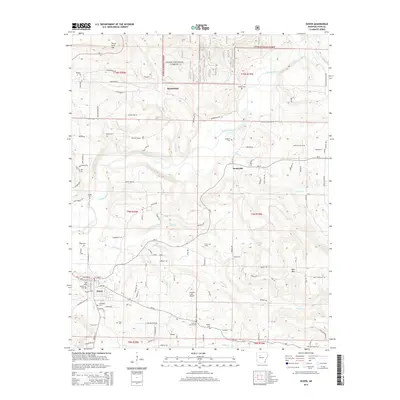
2014 Map of Dover
USGS Topo · Published 2014About this map
Illinois Bayou winds through the central corridor of this Pope County landscape, serving as a primary drainage for the surrounding heights of the Ozark National Forest. The settlement of Dover anchors the southwest, showing a dense network of residential streets and local landmarks like the Jamison Cem and McFadden Cem. To the north and east, the terrain becomes increasingly complex as it rises toward Three Knob Mtn and Buck Mtn. This area is marked by a legacy of resource extraction, evidenced by the Scottsville Gas Field and Dover Gas Field. Smaller communities such as Scottsville and Broomfield are linked by a web of rural routes, including Ar-7 and Ar-27, while the Landers Loop Airport provides a localized aviation hub amidst the many creeks and ridges.
Find a feature on this map
113 named features on this map. Tap any name to fly to it.
Don’t see what you’re looking for? This feature index may not catch every label — zoom into the map to look around manually.
Map Details
Editions of this 2014 Dover Map
This is the sole edition of this map. No revisions or reprints were ever made.
Other maps of this area

1879 · Washington
USGS Topo · 1:62,500

1887 · Smyrna
USGS Topo · 1:62,500

1888 · Dardanelle #1
USGS Topo · 1:62,500

1889 · Treat
USGS Topo · 1:62,500

1889 · Marshall #3
USGS Topo · 1:62,500

1890 · Dardanelle
USGS Topo · 1:125,000

1892 · Marshall
USGS Topo · 1:125,000

1892 · Morrillton
USGS Topo · 1:125,000

1894 · Morrillton
USGS Topo · 1:125,000

1894 · Marshall
USGS Topo · 1:125,000