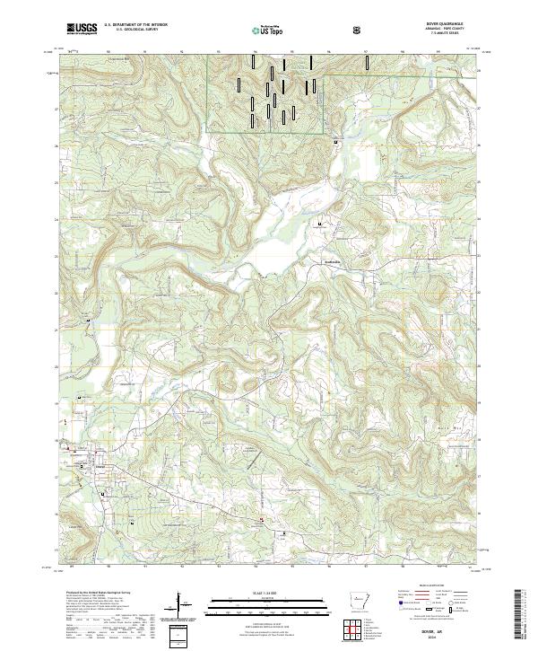
2024 Map of Dover
USGS Topo · Published 2024About this map
Dover and the nearby settlement of Scottsville anchor this Pope County landscape, where the southern reaches of the Ozark National Forest meet a complex network of valley drainages. The Illinois Bayou and its many tributaries, including Little Creek, Mud Creek, and McCoy Creek, carve through the terrain, creating a distinct pattern of ridges like Three Knob Mtn and Buck Mtn. This modern survey reveals a dense concentration of historical burial sites, such as Goates Cem, Langford Cem, and Jamison Cem, which are invaluable for genealogical research in this part of Arkansas.
Find a feature on this map
115 named features on this map. Tap any name to fly to it.
Don’t see what you’re looking for? This feature index may not catch every label — zoom into the map to look around manually.
Map Details
Editions of this 2024 Dover Map
This is the sole edition of this map. No revisions or reprints were ever made.