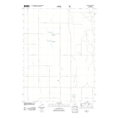
2011 Map of Dover
USGS Topo · Published 2011About this map
Lone Tree Creek and its seasonal tributaries define the landscape of this portion of Weld County. The settlement of Dover sits at a central crossroads, surrounded by a grid of rural routes that facilitate movement through this high plains environment. Water management is a central theme of the geography here, evidenced by the series of catchments such as Giffon Number 1 Reservoir and Giffon Number 2 Reservoir along the creek beds. Further south, Dover Reservoir and its associated Dover Dam highlight the engineering required to sustain agriculture and local needs. Other drainages, including Spring Creek and Little Owl Creek, cut through the terrain, illustrating the natural drainage patterns of the region during a time of modern rural development.
Find a feature on this map
26 named features on this map. Tap any name to fly to it.
Don’t see what you’re looking for? This feature index may not catch every label — zoom into the map to look around manually.
Map Details
Editions of this 2011 Dover Map
This is the sole edition of this map. No revisions or reprints were ever made.
Other maps of this area

1908 · Eaton
USGS Topo · 1:125,000

1910 · Eaton
USGS Topo · 1:125,000

1954 · Greeley
USGS Topo · 1:250,000

1957 · Greeley
USGS Topo · 1:250,000

1958 · Greeley
USGS Topo · 1:250,000
1960 · Cobb Lake
USGS Topo · 1:24,000
1960 · Nunn
USGS Topo · 1:24,000
1960 · Antelope Reservoir
USGS Topo · 1:24,000

1961 · Greeley
USGS Topo · 1:250,000

1964 · Greeley
USGS Topo · 1:250,000