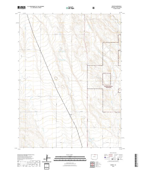
2022 Map of Dover
USGS Topo · Published 2022About this map
Dover is positioned at the intersection of several county roads in the northern Colorado plains, serving as a primary focal point in this high-plains landscape. The map reveals an intricate network of seasonal watercourses and man-made water storage, including Lone Tree Cr and Spring Cr which wind through the township grids. Agricultural water management is evident through the presence of Giffon Number 1 Reservoir and Giffon Number 2 Reservoir, along with Dover Reservoir to the southeast. The eastern portion of the quadrangle is defined by the open reaches of the Pawnee National Grassland, where Little Owl Cr and Owl Creek traverse the prairie. This 2022 survey documents the persistent grid-based settlement pattern of Weld County, characterized by a systematic road network such as Co RD 110 and Co RD 27 that organizes the vast grazing and ranching lands.
Find a feature on this map
30 named features on this map. Tap any name to fly to it.
Don’t see what you’re looking for? This feature index may not catch every label — zoom into the map to look around manually.
Map Details
Editions of this 2022 Dover Map
This is the sole edition of this map. No revisions or reprints were ever made.
Other maps of this area

1908 · Eaton
USGS Topo · 1:125,000

1910 · Eaton
USGS Topo · 1:125,000

1954 · Greeley
USGS Topo · 1:250,000

1957 · Greeley
USGS Topo · 1:250,000

1958 · Greeley
USGS Topo · 1:250,000
1960 · Cobb Lake
USGS Topo · 1:24,000
1960 · Nunn
USGS Topo · 1:24,000
1960 · Antelope Reservoir
USGS Topo · 1:24,000

1961 · Greeley
USGS Topo · 1:250,000

1964 · Greeley
USGS Topo · 1:250,000