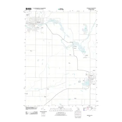
2011 Map of Dowagiac
USGS Topo · Published 2011About this map
Dowagiac serves as the primary urban hub on this southwest Michigan landscape, where the Dowagiac Creek winds through the center of town past the Riverside Cemetery and Mill Pond. The map reveals a dense network of rural burial grounds that speak to the long-standing family histories of Cass County, including Dewey Cemetery, Van Riper Cemetery, and Whitmanville Cemetery. These sites are scattered around smaller settlements like La Grange and Dailey, which maintain their distinct identities amidst the agricultural grid. To the southeast, Cassopolis anchors the area near Stone Lake, providing a secondary focus of civic life at the Cassopolis Post Office and the nearby Cass County Fairgrounds. The waterway system, including Pokagon Creek and La Grange Lake, remains a central feature, supporting recreational spots such as Camp Baber and the Cool Springs Campground.
Find a feature on this map
31 named features on this map. Tap any name to fly to it.
Don’t see what you’re looking for? This feature index may not catch every label — zoom into the map to look around manually.
Map Details
Editions of this 2011 Dowagiac Map
This is the sole edition of this map. No revisions or reprints were ever made.
Other maps of this area

1927 · Hartford
USGS Topo · 1:62,500

1931 · Hartford
USGS Topo · 1:62,500

1944 · Marcellus
USGS Topo · 1:62,500

1945 · Cassopolis
USGS Topo · 1:62,500

1946 · Marcellus
USGS Topo · 1:62,500

1947 · Cassopolis
USGS Topo · 1:62,500

1948 · Vandalia
USGS Topo · 1:62,500

1949 · Vandalia
USGS Topo · 1:62,500

1953 · Fort Wayne
USGS Topo · 1:250,000

1953 · Chicago
USGS Topo · 1:250,000