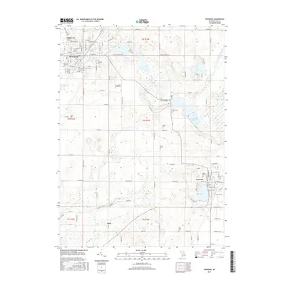
2017 Map of Dowagiac
USGS Topo · Published 2017About this map
Dowagiac and Cassopolis anchor this portion of Cass County, showing a landscape defined by glacial lakes and a network of rural cemeteries. The area around La Grange is particularly notable for its concentration of water bodies, including La Grange Lake and Kelsey Lake, which are bordered by numerous burial grounds such as Van Riper Cem and Whitmanville Cem. The northern section of the map is dominated by the Dowagiac municipal area, where the Dowagiac Municipal Airport and Southwestern Michigan Coll represent modern infrastructure alongside the historic corridor of Dowagiac Creek. Further south, the map details the small settlement of Dailey and the significant basin of Stone Lake adjacent to the county seat. This geography highlights the persistent importance of early settlement patterns, where town centers and homesteads were consistently positioned near the plentiful water sources of the region.
Find a feature on this map
78 named features on this map. Tap any name to fly to it.
Don’t see what you’re looking for? This feature index may not catch every label — zoom into the map to look around manually.
Map Details
Editions of this 2017 Dowagiac Map
This is the sole edition of this map. No revisions or reprints were ever made.
Other maps of this area

1927 · Hartford
USGS Topo · 1:62,500

1931 · Hartford
USGS Topo · 1:62,500

1944 · Marcellus
USGS Topo · 1:62,500

1945 · Cassopolis
USGS Topo · 1:62,500

1946 · Marcellus
USGS Topo · 1:62,500

1947 · Cassopolis
USGS Topo · 1:62,500

1948 · Vandalia
USGS Topo · 1:62,500

1949 · Vandalia
USGS Topo · 1:62,500

1953 · Fort Wayne
USGS Topo · 1:250,000

1953 · Chicago
USGS Topo · 1:250,000