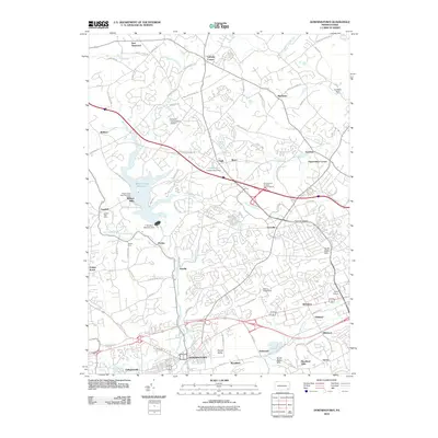
2010 Map of Downingtown
USGS Topo · Published 2010About this map
Downingtown serves as the southern anchor for this map of Chester County, where the sprawling suburban landscape meets the carefully preserved waters of the Marsh Creek Reservoir. The northern reaches are characterized by historic crossroads like Ludwigs Corner and East Nantmeal, while the central portion shows the modern convergence of transport and commerce at the Pennsylvania Turnpike Interchange 23 and Lionville. Significant water infrastructure is visible, including the F Houston McIlvain Dam and Beaver Creek Dam, which manage the local drainage basins of the East Branch Brandywine Creek and Valley Creek. Local history is preserved in the placement of the Lyndell Post Office and the vanished memory of Milford Mills, illustrating the ongoing transformation from a rural agricultural district to a contemporary residential and industrial corridor.
Find a feature on this map
94 named features on this map. Tap any name to fly to it.
Don’t see what you’re looking for? This feature index may not catch every label — zoom into the map to look around manually.
Map Details
Editions of this 2010 Downingtown Map
This is the sole edition of this map. No revisions or reprints were ever made.
Other maps of this area

1901 · West Chester
USGS Topo · 1:62,500

1904 · West Chester
USGS Topo · 1:62,500

1904 · Coatesville
USGS Topo · 1:62,500

1905 · Honey Brook
USGS Topo · 1:62,500

1906 · Phoenixville
USGS Topo · 1:62,500

1906 · Coatesville
USGS Topo · 1:62,500

1907 · Honeybrook
USGS Topo · 1:62,500

1918 · Coatesville
USGS Topo · 1:62,500

1941 · Honeybrook
USGS Topo · 1:62,500

1943 · Coatesville
USGS Topo · 1:62,500
Featured Places
- Caln Township, PA
- Downingtown, PA
- Lionville, Uwchlan Township
- West Pikeland Township, PA
- Wallace Township, PA