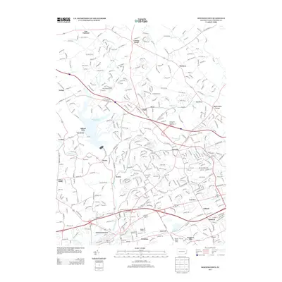
2013 Map of Downingtown
USGS Topo · Published 2013About this map
Downingtown serves as the focal point for this Chester County landscape, where the waters of E Br Brandywine Cr and Beaver Cr converge. The northern portion of the quadrangle is dominated by the Marsh Creek Reservoir, a significant geographic feature that reshaped the local topography near the former site of Milford Mills. This modern survey reveals a complex network of suburban development and historical crossroads, from the commerce at Lionville to the smaller settlements of Lyndell and Anselma. The presence of Pennsylvania Turnpike Interchange 23 at Eagle signifies the area's role as a major transportation corridor, while small aviation facilities like Fetters Construction Airport punctuate the remaining open spaces between expanding residential communities like Bradford Hills and North Valley Hills.
Find a feature on this map
37 named features on this map. Tap any name to fly to it.
Don’t see what you’re looking for? This feature index may not catch every label — zoom into the map to look around manually.
Map Details
Editions of this 2013 Downingtown Map
This is the sole edition of this map. No revisions or reprints were ever made.
Other maps of this area

1901 · West Chester
USGS Topo · 1:62,500

1904 · West Chester
USGS Topo · 1:62,500

1904 · Coatesville
USGS Topo · 1:62,500

1905 · Honey Brook
USGS Topo · 1:62,500

1906 · Phoenixville
USGS Topo · 1:62,500

1906 · Coatesville
USGS Topo · 1:62,500

1907 · Honeybrook
USGS Topo · 1:62,500

1918 · Coatesville
USGS Topo · 1:62,500

1941 · Honeybrook
USGS Topo · 1:62,500

1943 · Coatesville
USGS Topo · 1:62,500
Featured Places
- Caln Township, PA
- Downingtown, PA
- Lionville, Uwchlan Township
- West Pikeland Township, PA
- Wallace Township, PA