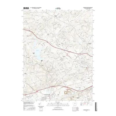
2016 Map of Downingtown
USGS Topo · Published 2016About this map
Downingtown serves as the focal point of this regional study, situated at a major crossroads where the E Br Brandywine Cr flows through the valley. The landscape is defined by the transition from the rolling North Valley Hills to the significant water management of the Marsh Cr Reservoir. This area reflects the dense, interconnected suburban development characteristic of early 21st-century Chester County, where legacy settlements like Milford Mills and Lionville are integrated into a modern transportation grid including Interstate 76 and Route 100.
Find a feature on this map
44 named features on this map. Tap any name to fly to it.
Don’t see what you’re looking for? This feature index may not catch every label — zoom into the map to look around manually.
Map Details
Editions of this 2016 Downingtown Map
This is the sole edition of this map. No revisions or reprints were ever made.
Other maps of this area

1901 · West Chester
USGS Topo · 1:62,500

1904 · West Chester
USGS Topo · 1:62,500

1904 · Coatesville
USGS Topo · 1:62,500

1905 · Honey Brook
USGS Topo · 1:62,500

1906 · Phoenixville
USGS Topo · 1:62,500

1906 · Coatesville
USGS Topo · 1:62,500

1907 · Honeybrook
USGS Topo · 1:62,500

1918 · Coatesville
USGS Topo · 1:62,500

1941 · Honeybrook
USGS Topo · 1:62,500

1943 · Coatesville
USGS Topo · 1:62,500
Featured Places
- Caln Township, PA
- Downingtown, PA
- Lionville, Uwchlan Township
- West Pikeland Township, PA
- Wallace Township, PA