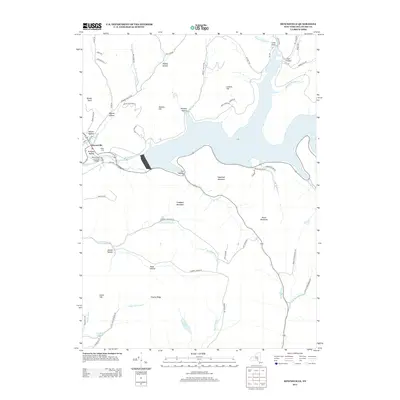
2013 Map of Downsville
USGS Topo · Published 2013About this map
The Downsville Covered Bridge serves as a focal point for this landscape in the western Catskills, where the East Branch Delaware River is dominated by the Pepacton Reservoir's infrastructure. The village of Downsville sits just below the massive Downsville Dam, a structure that fundamentally altered the valley's character and drainage. Surrounding the valley, numerous family-named hollows and cloves, such as Telford Hollow, Coles Clove, and Gregory Hollow, reflect the settlement patterns of Delaware County's upland farming history. The terrain is defined by prominent peaks including Sugarloaf Mountain and Campbell Mountain, while quiet cemeteries like Paige Cem and water bodies such as Cables Lake and Edwards Pond are preserved across the ridges. This map captures the region's balance between deep-rooted local heritage and the modern engineering of the New York City water supply system.
Find a feature on this map
73 named features on this map. Tap any name to fly to it.
Don’t see what you’re looking for? This feature index may not catch every label — zoom into the map to look around manually.
Map Details
Editions of this 2013 Downsville Map
This is the sole edition of this map. No revisions or reprints were ever made.
Other maps of this area

1920 · Long Eddy
USGS Topo · 1:62,500

1921 · Long Eddy
USGS Topo · 1:48,000

1921 · Livingston Manor
USGS Topo · 1:62,500

1922 · Andes
USGS Topo · 1:62,500

1923 · Long Eddy
USGS Topo · 1:62,500

1923 · Walton
USGS Topo · 1:48,000

1923 · Livingston Manor
USGS Topo · 1:62,500

1924 · Andes
USGS Topo · 1:62,500

1925 · Walton
USGS Topo · 1:62,500

1943 · Honesdale
USGS Topo · 1:125,000