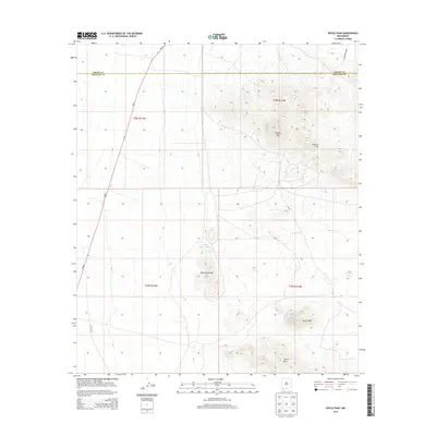
2013 Map of Doyle Peak
USGS Topo · Published 2013About this map
Apache Peak and the surrounding Apache Hills dominate the northeastern portion of this High Desert landscape, which straddles the boundary between Grant and Hidalgo counties. This arid region is characterized by isolated peaks and ridges that served as crucial navigation points and catchment areas for ranchers and travelers in the early 21st century. Grounded by water management features like Chapo Tank and Little Chapo Tank, the terrain reveals the necessity of surface storage in an environment otherwise defined by its sparse vegetation and sharp relief.
Find a feature on this map
15 named features on this map. Tap any name to fly to it.
Don’t see what you’re looking for? This feature index may not catch every label — zoom into the map to look around manually.
Map Details
Editions of this 2013 Doyle Peak Map
This is the sole edition of this map. No revisions or reprints were ever made.
Other maps of this area

1918 · Big Hatchet Peak
USGS Topo · 1:62,500

1918 · Hachita
USGS Topo · 1:62,500

1918 · Victorio
USGS Topo · 1:62,500

1955 · Douglas
USGS Topo · 1:250,000

1959 · Douglas
USGS Topo · 1:250,000

1961 · Douglas
USGS Topo · 1:250,000

1964 · Douglas
USGS Topo · 1:250,000
1964 · Hat Top Mountain
USGS Topo · 1:24,000
1965 · Victorio Ranch
USGS Topo · 1:24,000
1982 · Doyle Peak
USGS Topo · 1:24,000