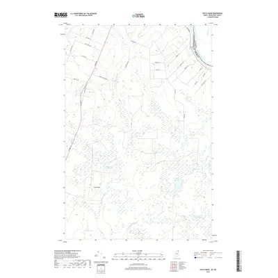
2018 Map of Doyle Ridge
USGS Topo · Published 2018About this map
The international border between the United States and Canada follows the course of the Saint John River in the northeast corner of this Maine landscape. Moving inland from the river, the terrain is defined by a dense network of local roads bearing the names of early settling families, such as Abel Cyr Rd, Edmond Ouelette Rd, and Vaillancourt Hill Rd. Central to the area is Doyle Ridge, a prominent elevation surrounded by an intricate wetland system including Orchard Bog and numerous small water bodies.
Find a feature on this map
35 named features on this map. Tap any name to fly to it.
Don’t see what you’re looking for? This feature index may not catch every label — zoom into the map to look around manually.
Map Details
Editions of this 2018 Doyle Ridge Map
This is the sole edition of this map. No revisions or reprints were ever made.
Other maps of this area

1921 · Van Buren
USGS Topo · 1:250,000

1927 · Stockholm
USGS Topo · 1:48,000

1929 · Caribou
USGS Topo · 1:48,000

1930 · Fort Fairfield
USGS Topo · 1:48,000

1931 · Van Buren
USGS Topo · 1:48,000

1931 · Stockholm
USGS Topo · 1:62,500

1932 · Caribou
USGS Topo · 1:62,500

1933 · Fort Fairfield
USGS Topo · 1:62,500

1934 · Van Buren
USGS Topo · 1:62,500

1951 · Van Buren
USGS Topo · 1:62,500