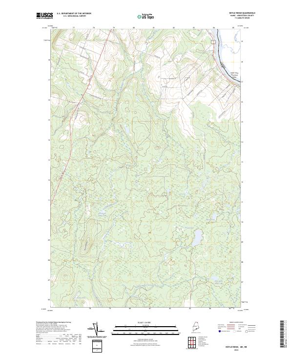
2024 Map of Doyle Ridge
USGS Topo · Published 2024About this map
Doyle Ridge and the Upper Saint John River Valley anchor this topographical study of the international boundary between Maine and Canada. The landscape is defined by an extensive network of northern waterways and wetlands, including Hammond Brook Lake, Dubay Lake, and the expansive Orchard Bog. This drainage system feeds the Saint John River, which marks the northeastern edge of the quadrangle. The road network reflects a history of rural land use and family ownership, with numerous routes named for local inhabitants, such as Edmond Ouellette Rd, Vaillancourt Hill Rd, and Albert Cyr Rd. This configuration of roads and water bodies suggests a region where forestry and agriculture have long adapted to the undulating terrain of the Maine north woods.
Find a feature on this map
37 named features on this map. Tap any name to fly to it.
Don’t see what you’re looking for? This feature index may not catch every label — zoom into the map to look around manually.
Map Details
Editions of this 2024 Doyle Ridge Map
This is the sole edition of this map. No revisions or reprints were ever made.
Other maps of this area

1921 · Van Buren
USGS Topo · 1:250,000

1927 · Stockholm
USGS Topo · 1:48,000

1929 · Caribou
USGS Topo · 1:48,000

1930 · Fort Fairfield
USGS Topo · 1:48,000

1931 · Van Buren
USGS Topo · 1:48,000

1931 · Stockholm
USGS Topo · 1:62,500

1932 · Caribou
USGS Topo · 1:62,500

1933 · Fort Fairfield
USGS Topo · 1:62,500

1934 · Van Buren
USGS Topo · 1:62,500

1951 · Van Buren
USGS Topo · 1:62,500