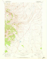
1968 Map of Drake Peak
USGS Topo · Published 1972About this map
Drake Peak and the high ridges of the Fremont National Forest dominate this high-desert landscape in Lake County during the late 1960s. The drainage patterns of Twelvemile Creek, Drake Creek, and McDowell Creek define the topography, supporting isolated outposts of human activity in this arid region. Evidence of cattle ranching and early land use is found at Deboy Ranch and the remote Vinyard Cabin, both situated near vital water sources.
Find a feature on this map
20 named features on this map. Tap any name to fly to it.
Don’t see what you’re looking for? This feature index may not catch every label — zoom into the map to look around manually.
Map Details
Editions of this 1968 Drake Peak Map
This is the sole edition of this map. No revisions or reprints were ever made.
Other maps of this area

1955 · Klamath Falls
USGS Topo · 1:250,000

1955 · Adel
USGS Topo · 1:250,000

1957 · Adel
USGS Topo · 1:250,000

1958 · Klamath Falls
USGS Topo · 1:250,000

1958 · Adel
USGS Topo · 1:250,000

1962 · Adel
USGS Topo · 1:250,000

1967 · Plush
USGS Topo · 1:24,000

1967 · Priday Reservoir
USGS Topo · 1:24,000
1968 · Sage Hen Butte
USGS Topo · 1:24,000

1968 · Crook Peak
USGS Topo · 1:24,000