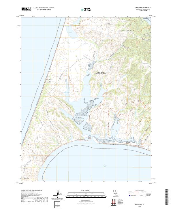
2021 Map of Drakes Bay
USGS Topo · Published 2021About this map
Point Reyes National Seashore dominates this coastal landscape, where the Pacific Ocean meets a complex network of estuarine inlets and sandy peninsulas. The terrain is defined by the high spine of Inverness Ridge to the east and the expansive Drakes Bay to the south. Significant water bodies like Abbotts Lagoon and the branching arms of Schooner Bay and Barries Bay illustrate the intricate shoreline.
Find a feature on this map
48 named features on this map. Tap any name to fly to it.
Don’t see what you’re looking for? This feature index may not catch every label — zoom into the map to look around manually.
Map Details
Editions of this 2021 Drakes Bay Map
This is the sole edition of this map. No revisions or reprints were ever made.
Other maps of this area

1916 · Point Reyes
USGS Topo · 1:48,000

1918 · Point Reyes
USGS Topo · 1:62,500

1947 · Santa Rosa
USGS Topo · 1:250,000

1947 · San Francisco
USGS Topo · 1:250,000

1948 · San Francisco
USGS Topo · 1:250,000

1949 · Santa Rosa
USGS Topo · 1:250,000

1953 · Drakes Bay
USGS Topo · 1:24,000
1954 · Point Reyes NE
USGS Topo · 1:24,000
1954 · Inverness
USGS Topo · 1:24,000
1954 · Tomales
USGS Topo · 1:24,000