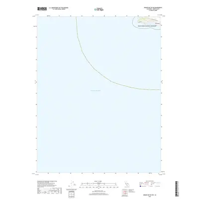
2018 Map of Drakes Bay OE SW
USGS Topo · Published 2018About this map
Point Reyes National Seashore dominates the small terrestrial portion of this maritime-heavy survey, capturing the extreme western tip of the peninsula. The rugged coastline is defined by the prominent Point Reyes headland, where the historic Lighthouse stands as a sentinel over the Pacific Ocean. This 2018 edition illustrates the remote character of the coastal shelf, where Sir Francis Drake Blvd provides the primary access to these windswept heights. The map focuses on the interface between land and sea, highlighting secluded features like Sea Lion Cove along the rocky shoreline. It is a portrait of a landscape preserved for its natural and maritime history, showing the minimal modern development on this federally protected point.
Find a feature on this map
6 named features on this map. Tap any name to fly to it.
Don’t see what you’re looking for? This feature index may not catch every label — zoom into the map to look around manually.
Map Details
Editions of this 2018 Drakes Bay OE SW Map
This is the sole edition of this map. No revisions or reprints were ever made.
Other maps of this area

1916 · Point Reyes
USGS Topo · 1:48,000

1918 · Point Reyes
USGS Topo · 1:62,500

1947 · Santa Rosa
USGS Topo · 1:250,000

1947 · San Francisco
USGS Topo · 1:250,000

1948 · San Francisco
USGS Topo · 1:250,000

1949 · Santa Rosa
USGS Topo · 1:250,000

1953 · Drakes Bay
USGS Topo · 1:24,000
1954 · Point Reyes
USGS Topo · 1:62,500

1955 · San Francisco
USGS Topo · 1:250,000

1956 · San Francisco
USGS Topo · 1:250,000