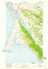
1954 Map of Point Reyes
USGS Topo · Published 1959About this map
Tomales Bay bisects the landscape in this mid-century survey, separating the pastoral ranching lands of the Point Reyes peninsula from the coastal hills of western Marin County. The peninsula is characterized by extensive family dairy operations, including Upper Pierce Ranch, Kehoe Ranch, and Bear Valley Ranch, alongside maritime infrastructure like the Radio Sta and the Lighthouse at the western tip. On the eastern shore, the Point Reyes Station and Olema serve as inland hubs, while the College of Pacific Marine Sta of Biological Science at Dillon Beach represents the area's growing academic and scientific interests. The presence of several historic sites, such as the Blacksmith Shop (Site) and Schooner Ldg (Site), provides a window into the evolution of local commerce and transportation before the establishment of the national seashore.
Find a feature on this map
87 named features on this map. Tap any name to fly to it.
Don’t see what you’re looking for? This feature index may not catch every label — zoom into the map to look around manually.
Map Details
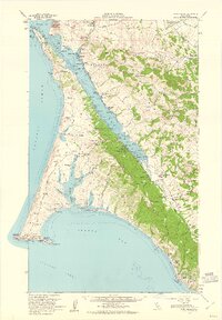
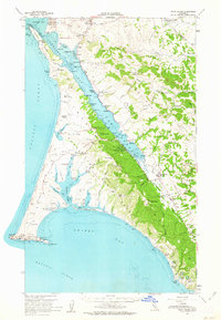
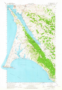
Editions of this 1954 Point Reyes Map
5 editions found
Historical Maps of Bivalve Through Time
58 maps found

1897 Tamalpais
Marin County, CA

1916 Point Reyes
Marin County, CA

1918 Point Reyes
Marin County, CA

1941 Tamalpais
Marin County, CA

1947 San Quentin
Marin County, CA

1948 San Quentin
Marin County, CA

1950 Mt. Tamalpais
Marin County, CA

1951 Petaluma Point
Marin County, CA

1953 Drakes Bay
Marin County, CA

1954 Double Point
Marin County, CA

1954 Point Bonita
Marin County, CA

1954 Point Reyes
Marin County, CA

1954 Point Reyes NE
Marin County, CA

1959 Petaluma Point
Marin County, CA

1959 San Quentin
Marin County, CA

1993 Double Point
Marin County, CA

1993 Point Bonita
Marin County, CA

1993 San Quentin
Marin County, CA

1994 Double Point
Marin County, CA

1995 Drakes Bay
Marin County, CA

1995 Point Reyes NE
Marin County, CA

1995 San Quentin
Marin County, CA

2012 Double Point
Marin County, CA

2012 Drakes Bay
Marin County, CA

2012 Drakes Bay OE S
Marin County, CA

2012 Drakes Bay OE SW
Marin County, CA

2012 Drakes Bay OE W
Marin County, CA

2012 Petaluma Point
Marin County, CA

2012 Point Bonita
Marin County, CA

2012 Point Reyes NE
Marin County, CA

2012 San Quentin
Marin County, CA

2015 Double Point
Marin County, CA

2015 Drakes Bay
Marin County, CA

2015 Drakes Bay OE S
Marin County, CA

2015 Drakes Bay OE SW
Marin County, CA

2015 Drakes Bay OE W
Marin County, CA

2015 Petaluma Point
Marin County, CA

2015 Point Bonita
Marin County, CA

2015 Point Reyes NE
Marin County, CA

2015 San Quentin
Marin County, CA

2018 Double Point
Marin County, CA

2018 Drakes Bay
Marin County, CA

2018 Drakes Bay OE S
Marin County, CA

2018 Drakes Bay OE SW
Marin County, CA

2018 Drakes Bay OE W
Marin County, CA

2018 Petaluma Point
Marin County, CA

2018 Point Bonita
Marin County, CA

2018 Point Reyes NE
Marin County, CA

2018 San Quentin
Marin County, CA

2021 Double Point
Marin County, CA

2021 Drakes Bay
Marin County, CA

2021 Drakes Bay OE S
Marin County, CA

2021 Drakes Bay OE SW
Marin County, CA

2021 Drakes Bay OE W
Marin County, CA

2021 Point Bonita
Marin County, CA

2021 Point Reyes NE
Marin County, CA

2021 San Quentin
Marin County, CA

2022 Petaluma Point
Marin County, CA