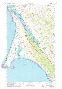
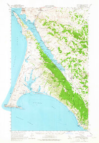
1954 Map of Point Reyes
USGS Topo · Published 1969About this map
The dramatic shoreline of Point Reyes National Seashore and the long, linear corridor of Tomales Bay define this mid-century coastal landscape. This survey documents the area's transition into a protected environment while still showing the active ranching culture, with numerous family-named holdings like Kehoe Ranch, Lairds Ldg, and McClures Ranch dotted across the peninsula. The settlement of Point Reyes Station serves as the inland hub, while the Lighthouse stands watch at the extreme western tip of Point Reyes. Along the eastern shore of the bay, the map details the infrastructure of the period, including the Two Rock Ranch Station Mil Res and the Univ of Pacific Marine Sta of Biological Science. The complex hydrology of the San Andreas Rift Zone is clearly visible, shaping the orientation of the bay and the surrounding ridges.
Find a feature on this map
98 named features on this map. Tap any name to fly to it.
Don’t see what you’re looking for? This feature index may not catch every label — zoom into the map to look around manually.
Map Details
Editions of this 1954 Point Reyes Map
5 editions found
Other maps of this area

1897 · Tamalpais
USGS Topo · 1:62,500

1914 · Petaluma
USGS Topo · 1:62,500

1916 · Santa Rosa
USGS Topo · 1:62,500

1916 · Point Reyes
USGS Topo · 1:48,000

1918 · Point Reyes
USGS Topo · 1:62,500

1935 · Sebastopol
USGS Topo · 1:48,000

1941 · Tamalpais
USGS Topo · 1:62,500

1942 · Sebastopol
USGS Topo · 1:62,500

1942 · Petaluma
USGS Topo · 1:62,500

1942 · Bodega Head
USGS Topo · 1:24,000