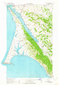
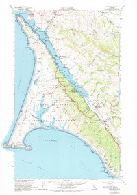
1954 Map of Point Reyes
USGS Topo · Published 1963About this map
Punta De Los Reyes dominates this mid-century coastal survey, capturing the ranching and maritime landscape of western Marin County. The map details the transition from the cattle operations at Upper Pierce Ranch and Home Ranch to the scientific development at the College of Pacific Marine Sta of Biological Science near Dillon Beach. The settlement pattern follows the intricate shoreline of Tomales Bay, where small landings like Lairds Ldg and Nicks Cove served the local community. Further inland, the map traces the Sir Francis Drake Highway as it connects Point Reyes Station to Olema and Inverness. This document is particularly valuable for genealogists and local historians, as it precisely locates family-named landmarks and rural infrastructure, including Olema Cem and the Marshall Sch, before the full impact of modern conservation efforts changed the peninsula's land use.
Find a feature on this map
99 named features on this map. Tap any name to fly to it.
Don’t see what you’re looking for? This feature index may not catch every label — zoom into the map to look around manually.
Map Details
Editions of this 1954 Point Reyes Map
5 editions found
Other maps of this area

1897 · Tamalpais
USGS Topo · 1:62,500

1914 · Petaluma
USGS Topo · 1:62,500

1916 · Santa Rosa
USGS Topo · 1:62,500

1916 · Point Reyes
USGS Topo · 1:48,000

1918 · Point Reyes
USGS Topo · 1:62,500

1935 · Sebastopol
USGS Topo · 1:48,000

1941 · Tamalpais
USGS Topo · 1:62,500

1942 · Sebastopol
USGS Topo · 1:62,500

1942 · Petaluma
USGS Topo · 1:62,500

1942 · Bodega Head
USGS Topo · 1:24,000