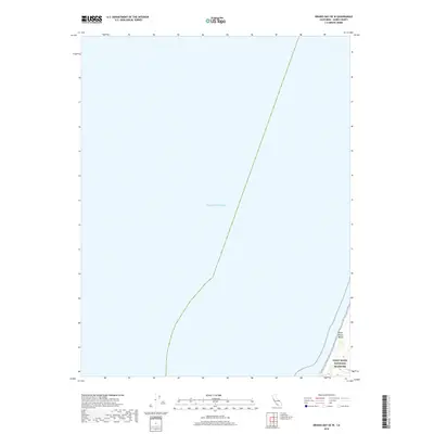
2018 Map of Drakes Bay OE W
USGS Topo · Published 2018About this map
Point Reyes National Seashore defines the narrow eastern margin of this coastal chart, where the land meets the vast Pacific Ocean. This 2018 survey focuses primarily on the maritime environment off the coast of Marin County, providing a high-resolution look at the shoreline at Point Reyes Beach. The topography here is limited to the immediate beach and the rising coastal bluffs that characterize this protected stretch of the California coast. Because the map covers the transition from open sea to the national seashore, it provides a precise modern record of the shoreline's position relative to the bathymetric boundary, useful for researchers tracking coastal erosion and the management of these federal parklands.
Find a feature on this map
3 named features on this map. Tap any name to fly to it.
Don’t see what you’re looking for? This feature index may not catch every label — zoom into the map to look around manually.
Map Details
Editions of this 2018 Drakes Bay OE W Map
This is the sole edition of this map. No revisions or reprints were ever made.
Other maps of this area

1916 · Point Reyes
USGS Topo · 1:48,000

1918 · Point Reyes
USGS Topo · 1:62,500

1947 · Santa Rosa
USGS Topo · 1:250,000

1947 · San Francisco
USGS Topo · 1:250,000

1948 · San Francisco
USGS Topo · 1:250,000

1949 · Santa Rosa
USGS Topo · 1:250,000

1953 · Drakes Bay
USGS Topo · 1:24,000
1954 · Tomales
USGS Topo · 1:24,000
1954 · Point Reyes
USGS Topo · 1:62,500

1955 · San Francisco
USGS Topo · 1:250,000