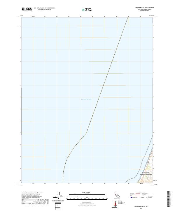
2021 Map of Drakes Bay OE W
USGS Topo · Published 2021About this map
Point Reyes National Seashore anchors the southeastern corner of this maritime-focused map, where the California coastline meets the Pacific Ocean. This specific quadrangle covers a significant expanse of open water, highlighting the nautical approaches to the Marin County coast. Along the narrow strip of land that appears on the eastern margin, Point Reyes Beach provides a distinct geographical landmark. The presence of the Point Reyes Beach Route Trl indicates the established recreational pathways that traverse the protected coastal sands, offering a look at the modern accessibility and conservation boundaries of this peninsula.
Find a feature on this map
4 named features on this map. Tap any name to fly to it.
Don’t see what you’re looking for? This feature index may not catch every label — zoom into the map to look around manually.
Map Details
Editions of this 2021 Drakes Bay OE W Map
This is the sole edition of this map. No revisions or reprints were ever made.
Other maps of this area

1916 · Point Reyes
USGS Topo · 1:48,000

1918 · Point Reyes
USGS Topo · 1:62,500

1947 · Santa Rosa
USGS Topo · 1:250,000

1947 · San Francisco
USGS Topo · 1:250,000

1948 · San Francisco
USGS Topo · 1:250,000

1949 · Santa Rosa
USGS Topo · 1:250,000

1953 · Drakes Bay
USGS Topo · 1:24,000
1954 · Tomales
USGS Topo · 1:24,000
1954 · Point Reyes
USGS Topo · 1:62,500

1955 · San Francisco
USGS Topo · 1:250,000