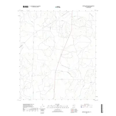
2019 Map of Dripping Springs Draw
USGS Topo · Published 2019About this map
Dripping Springs Draw defines the central topography of this Sterling County landscape, where dry watercourses and seasonal drainages weave through the West Texas terrain. This 2019 survey captures a network of rural county roads and private lanes that reflect the region's ranching heritage and modern land use. Key corridors like Horwood Sante Fe Rd and Marvin Foster Rd provide access to the interior, while significant water features such as Sterling Cr and Kiowa Cr trace the natural lowlands. The presence of named landmarks like James Hollow and Mulberry Cr alongside modern designations like FM 2139 illustrates a landscape where traditional geography meets contemporary infrastructure, offering a clear record of the area's rural development and physical layout.
Find a feature on this map
18 named features on this map. Tap any name to fly to it.
Don’t see what you’re looking for? This feature index may not catch every label — zoom into the map to look around manually.
Map Details
Editions of this 2019 Dripping Springs Draw Map
This is the sole edition of this map. No revisions or reprints were ever made.
Other maps of this area

1954 · San Angelo
USGS Topo · 1:250,000

1958 · San Angelo
USGS Topo · 1:250,000

1963 · Cumbie Draw
USGS Topo · 1:24,000

1963 · Glass Ranch
USGS Topo · 1:24,000

1965 · San Angelo
USGS Topo · 1:250,000

1972 · Sterling City
USGS Topo · 1:24,000

1972 · Dog Creek SW
USGS Topo · 1:24,000

1972 · Dog Creek NW
USGS Topo · 1:24,000

1973 · Hay Hollow
USGS Topo · 1:24,000
1973 · Coon Dive Draw
USGS Topo · 1:24,000