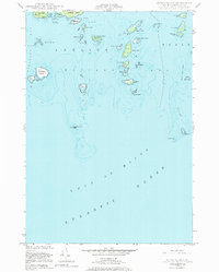
1948 Map of Drisko Island
USGS Topo · Published 1984About this map
Drisko Island and its surrounding archipelago dominate this maritime survey of Washington County's coast, where the Gulf of Maine meets the complex inlets of Pleasant Bay and Western Bay. The landscape is defined by its navigation hazards and natural harbors, from the sheltered Cape Split Harbor at Moose Neck to the exposed ledges of the outer islands. Coastal features like Big Nash Island and Flat Island are documented alongside numerous treacherous shoals such as Ram Island Ledge and Ladle Foul. Insights into the late 19th-century maritime environment are preserved here, as the hydrography is based on surveys dating back to 1870. The map records a series of prominent coastal landmarks including Black Rock, the high ground at Eastern Pitch, and the narrow passage at Tibbett Narrows, essential for local fishing and shipping routes of the era.
Find a feature on this map
52 named features on this map. Tap any name to fly to it.
Don’t see what you’re looking for? This feature index may not catch every label — zoom into the map to look around manually.
Map Details
Editions of this 1948 Drisko Island Map
2 editions found
Other maps of this area

1902 · Cherryfield
USGS Topo · 1:62,500

1904 · Cherryfield
USGS Topo · 1:62,500

1904 · Petit Manan
USGS Topo · 1:62,500

1921 · Great Wass Island
USGS Topo · 1:62,500

1921 · Columbia Falls
USGS Topo · 1:62,500

1941 · Columbia Falls
USGS Topo · 1:62,500

1942 · Cherryfield
USGS Topo · 1:62,500

1942 · Columbia Falls
USGS Topo · 1:62,500

1948 · Jonesport
USGS Topo · 1:24,000

1948 · Drisko Island
USGS Topo · 1:24,000