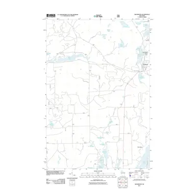
2011 Map of Drummond
USGS Topo · Published 2011About this map
The town of Drummond serves as the central hub of this northern Wisconsin landscape, situated along the Long Lake Branch and bounded by Drummond Lake. The area's hydrology is complex and managed, featuring both the Drummond Dam and the Cisco Lake Dam to the northeast. Beyond the main settlement, the map reveals a high density of small water bodies and vacation communities, such as Cisco Lake Summer Homes and the expansive Lake Owen in the southeast corner.
Find a feature on this map
57 named features on this map. Tap any name to fly to it.
Don’t see what you’re looking for? This feature index may not catch every label — zoom into the map to look around manually.
Map Details
Editions of this 2011 Drummond Map
This is the sole edition of this map. No revisions or reprints were ever made.
Other maps of this area

1943 · Namekagon Lake
USGS Topo · 1:48,000

1944 · Drummond
USGS Topo · 1:48,000

1944 · Grandview
USGS Topo · 1:48,000

1944 · Hayward
USGS Topo · 1:48,000

1945 · Namekagon Lake
USGS Topo · 1:48,000

1947 · Drummond
USGS Topo · 1:48,000

1947 · Grandview
USGS Topo · 1:48,000

1953 · Ashland
USGS Topo · 1:250,000

1958 · Ashland
USGS Topo · 1:250,000
1971 · Upper Eau Claire Lake
USGS Topo · 1:24,000