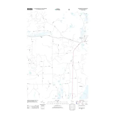
2013 Map of Drummond
USGS Topo · Published 2013About this map
The settlement of Drummond serves as the focal point for this survey of the Chequamegon-Nicolet National Forest region, situated where US Hwy 63 and Co Hwy N intersect. The landscape is defined by an intricate network of glacial lakes and forest roads, including numerous Forest Service routes like FR 228 and FR 218. Recreational and seasonal land use is evident through established sites such as the Old Chippewa Camp Ground and Lake Dinner Camp, alongside the Cisco Lake Summer Homes cluster in the northeast. Significant water bodies like the expansive Lake Owen and the smaller Mill Pond Lake indicate a landscape shaped by both natural hydrology and the historical needs of the local timber industry. The distribution of named lakes, from Lake Wilipyro to Lake Horseshoe, reflects a region deeply integrated with seasonal residence and forest management.
Find a feature on this map
62 named features on this map. Tap any name to fly to it.
Don’t see what you’re looking for? This feature index may not catch every label — zoom into the map to look around manually.
Map Details
Editions of this 2013 Drummond Map
This is the sole edition of this map. No revisions or reprints were ever made.
Other maps of this area

1943 · Namekagon Lake
USGS Topo · 1:48,000

1944 · Drummond
USGS Topo · 1:48,000

1944 · Grandview
USGS Topo · 1:48,000

1944 · Hayward
USGS Topo · 1:48,000

1945 · Namekagon Lake
USGS Topo · 1:48,000

1947 · Drummond
USGS Topo · 1:48,000

1947 · Grandview
USGS Topo · 1:48,000

1953 · Ashland
USGS Topo · 1:250,000

1958 · Ashland
USGS Topo · 1:250,000
1971 · Upper Eau Claire Lake
USGS Topo · 1:24,000