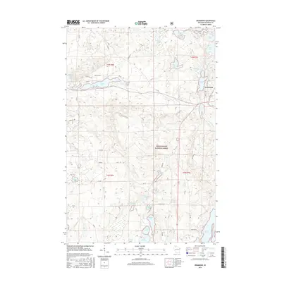
2015 Map of Drummond
USGS Topo · Published 2015About this map
Chequamegon National Forest defines the geography of this northern Wisconsin landscape, where glacial legacy is evident in a dense network of water bodies. The settlement of Drummond serves as the local hub, situated on the banks of Drummond Lake and Mill Pond Lake. This area is a patchwork of forest service roads and trails, including the North Country Trail which winds through the northeast corner past Armstrong Lake.
Find a feature on this map
69 named features on this map. Tap any name to fly to it.
Don’t see what you’re looking for? This feature index may not catch every label — zoom into the map to look around manually.
Map Details
Editions of this 2015 Drummond Map
This is the sole edition of this map. No revisions or reprints were ever made.
Other maps of this area

1943 · Namekagon Lake
USGS Topo · 1:48,000

1944 · Drummond
USGS Topo · 1:48,000

1944 · Grandview
USGS Topo · 1:48,000

1944 · Hayward
USGS Topo · 1:48,000

1945 · Namekagon Lake
USGS Topo · 1:48,000

1947 · Drummond
USGS Topo · 1:48,000

1947 · Grandview
USGS Topo · 1:48,000

1953 · Ashland
USGS Topo · 1:250,000

1958 · Ashland
USGS Topo · 1:250,000
1971 · Upper Eau Claire Lake
USGS Topo · 1:24,000