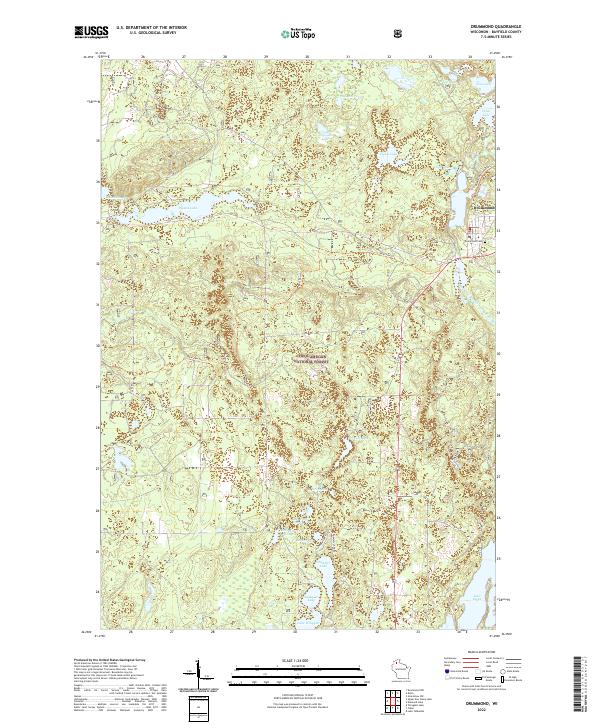
2022 Map of Drummond
USGS Topo · Published 2022About this map
Drummond sits at the eastern edge of this landscape, serving as a gateway to the dense woodlands of the Chequamegon National Forest. The area is defined by a dense network of glacial lakes and small ponds, including the elongated waters of Pigeon Lake and the northern reaches of Lake Owen. These water bodies are connected by a system of recreational and logging paths such as the Bear-Paw Trl and Drummond Connector Trl, which weave through the townships of T45N R8W and T44N R7W. Local landmarks like the Drummond Cem and the settlement at Lake-Dinner Camp offer specific points of interest for those tracing the history of this timber-rich region. The map reveals how the modern landscape is still deeply structured by its natural hydrology, from Stewart Lake in the south to Balsam Pond in the north.
Find a feature on this map
31 named features on this map. Tap any name to fly to it.
Don’t see what you’re looking for? This feature index may not catch every label — zoom into the map to look around manually.
Map Details
Editions of this 2022 Drummond Map
This is the sole edition of this map. No revisions or reprints were ever made.
Other maps of this area

1943 · Namekagon Lake
USGS Topo · 1:48,000

1944 · Drummond
USGS Topo · 1:48,000

1944 · Grandview
USGS Topo · 1:48,000

1944 · Hayward
USGS Topo · 1:48,000

1945 · Namekagon Lake
USGS Topo · 1:48,000

1947 · Drummond
USGS Topo · 1:48,000

1947 · Grandview
USGS Topo · 1:48,000

1953 · Ashland
USGS Topo · 1:250,000

1958 · Ashland
USGS Topo · 1:250,000
1971 · Upper Eau Claire Lake
USGS Topo · 1:24,000