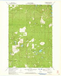
1971 Map of Drummond NW
USGS Topo · Published 1973About this map
Glacial topography and dense northern woodlands define this portion of the Chequamegon National Forest in the early 1970s. The landscape is dominated by a complex network of freshwater kettle lakes, including the prominent West Eightmile Lake and East Eightmile Lake. While largely undeveloped, the map reveals the layout of rural access routes like Webster Road and Barnes Road, which cut through the townships of Hughes, Barnes, and Drummond.
Find a feature on this map
22 named features on this map. Tap any name to fly to it.
Don’t see what you’re looking for? This feature index may not catch every label — zoom into the map to look around manually.
Map Details
Editions of this 1971 Drummond NW Map
2 editions found
Other maps of this area

1943 · Iron Lake
USGS Topo · 1:48,000

1944 · Drummond
USGS Topo · 1:48,000

1945 · Highland
USGS Topo · 1:48,000

1947 · Drummond
USGS Topo · 1:48,000

1947 · Brule
USGS Topo · 1:48,000

1947 · Iron Lake
USGS Topo · 1:48,000

1949 · Highland
USGS Topo · 1:48,000

1953 · Ashland
USGS Topo · 1:250,000

1958 · Ashland
USGS Topo · 1:250,000

1961 · Iron Lake SW
USGS Topo · 1:24,000