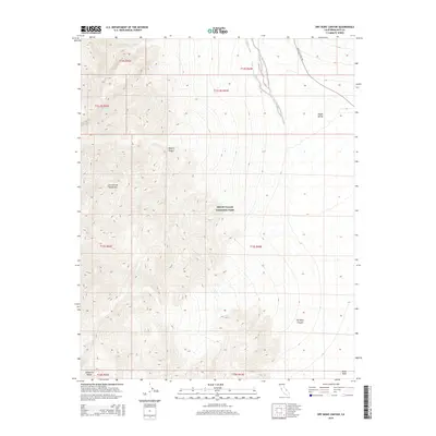
2015 Map of Dry Bone Canyon
USGS Topo · Published 2015About this map
Death Valley National Park encompasses this stark desert landscape, where the eastern slopes of the Cottonwood Mountains descend toward the valley floor. The terrain is defined by dramatic elevation changes, notably carved by Dry Bone Canyon as it drains toward the northeast. In the lower elevations, the Death Valley Wash serves as a primary corridor for seasonal runoff, running parallel to the modern alignment of Scotty's Castle Rd. This 2015 survey illustrates the geologic complexity of the Mojave Desert transition, capturing features such as the Niter Beds at the southern edge and the high ridges of the Panamint Range. The map detail emphasizes the drainage patterns and alluvial fans that characterize this portion of Death Valley, providing a clear look at the topographic contours of the Inyo County wilderness.
Find a feature on this map
17 named features on this map. Tap any name to fly to it.
Don’t see what you’re looking for? This feature index may not catch every label — zoom into the map to look around manually.
Map Details
Editions of this 2015 Dry Bone Canyon Map
This is the sole edition of this map. No revisions or reprints were ever made.
Other maps of this area

1908 · Ballarat
USGS Topo · 1:250,000

1913 · Ballarat
USGS Topo · 1:250,000

1948 · Death Valley
USGS Topo · 1:250,000

1951 · Marble Canyon
USGS Topo · 1:62,500

1952 · Stovepipe Wells
USGS Topo · 1:62,500

1954 · Death Valley
USGS Topo · 1:250,000

1956 · Death Valley
USGS Topo · 1:250,000

1957 · Death Valley
USGS Topo · 1:250,000
1957 · Grapevine Peak
USGS Topo · 1:62,500

1957 · Tin Mountain
USGS Topo · 1:62,500