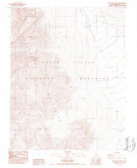
1986 Map of Dry Bone Canyon
USGS Topo · Published 1986About this map
Cottonwood Mountains rise dramatically along the western edge of Death Valley National Monument in this 1980s topographic study. The landscape is defined by the severe drainage patterns of Dry Bone Canyon, which cuts eastward through the high peaks toward the valley floor. The map illustrates the desolate hydrological network of the Mojave Desert, where seasonal runoff channels like Death Valley Wash carve deep into the alluvial fans. This survey captures the terrain prior to the 1994 expansion and redesignation of the area as a National Park, preserving the specific boundaries and designations of the original National Monument era. The intricate contour lines detail the extreme elevation shifts and narrow canyons characteristic of the Great Basin’s desert topography.
Find a feature on this map
4 named features on this map. Tap any name to fly to it.
Don’t see what you’re looking for? This feature index may not catch every label — zoom into the map to look around manually.
Map Details
Editions of this 1986 Dry Bone Canyon Map
This is the sole edition of this map. No revisions or reprints were ever made.
Other maps of this area

1908 · Ballarat
USGS Topo · 1:250,000

1913 · Ballarat
USGS Topo · 1:250,000

1948 · Death Valley
USGS Topo · 1:250,000

1951 · Marble Canyon
USGS Topo · 1:62,500

1952 · Stovepipe Wells
USGS Topo · 1:62,500

1954 · Death Valley
USGS Topo · 1:250,000

1956 · Death Valley
USGS Topo · 1:250,000

1957 · Death Valley
USGS Topo · 1:250,000
1957 · Grapevine Peak
USGS Topo · 1:62,500

1957 · Tin Mountain
USGS Topo · 1:62,500