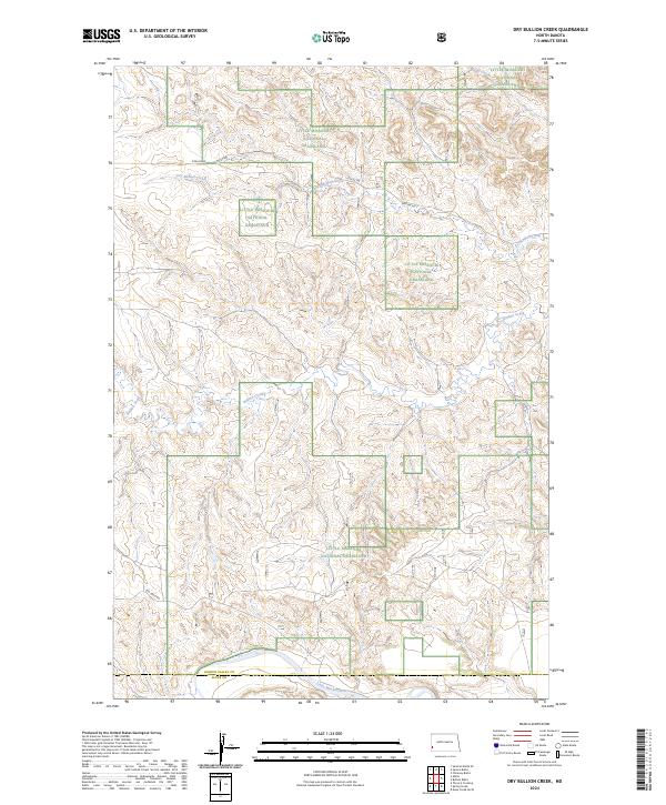
2024 Map of Dry Bullion Creek
USGS Topo · Published 2024About this map
Little Missouri National Grassland dominates this western North Dakota landscape, where the high plains break into a complex network of drainages and plateaus. The southern edge of the quadrangle is defined by the winding course of the Little Missouri River, which collects the seasonal flows of Bullion Creek and Dry Bullion Creek. Spanning the border of Golden Valley and Slope counties, the map reveals a sparsely settled region primarily organized by the Public Land Survey System. Modern infrastructure is limited to a few arterial paths like Pipeline Rd, Van Daele Rd, and 47th St SW, which trace the section lines and natural contours of the terrain. This map captures the intersection of conservation lands and the continuing legacy of the open range in the Badlands vicinity.
Find a feature on this map
15 named features on this map. Tap any name to fly to it.
Don’t see what you’re looking for? This feature index may not catch every label — zoom into the map to look around manually.
Map Details
Editions of this 2024 Dry Bullion Creek Map
This is the sole edition of this map. No revisions or reprints were ever made.
Other maps of this area

1953 · Dickinson
USGS Topo · 1:250,000

1957 · Dickinson
USGS Topo · 1:250,000

1979 · Deep Creek North
USGS Topo · 1:24,000

1979 · Sentinel Butte SE
USGS Topo · 1:24,000

1979 · Three V Crossing
USGS Topo · 1:24,000
1979 · Chimney Butte
USGS Topo · 1:24,000

1979 · Square Butte
USGS Topo · 1:24,000

1979 · Bullion Butte
USGS Topo · 1:24,000

1980 · Spring Creek
USGS Topo · 1:24,000

1980 · Alpha
USGS Topo · 1:24,000