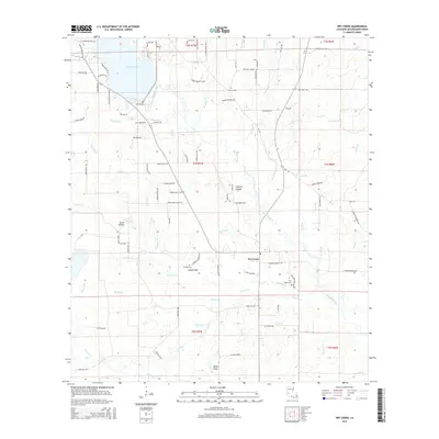
2015 Map of Dry Creek
USGS Topo · Published 2015About this map
Bundick Lake dominates the northwest corner of this Louisiana landscape, where the waters of Bundick Creek and several smaller tributaries like Cherry Br and Farris Br converge. The topography is defined by a dense network of watercourses and low-lying drainages, including the appropriately named Steep Gully and Miller Gully. Small communities and named clusters like Dry Creek and Hickory Hollow are connected by a web of local roads, many of which carry family names such as Tommy Bailey Rd, Alvin Reed Rd, and Frank Miller Rd, suggesting a landscape of long-standing family landholdings.
Find a feature on this map
101 named features on this map. Tap any name to fly to it.
Don’t see what you’re looking for? This feature index may not catch every label — zoom into the map to look around manually.
Map Details
Editions of this 2015 Dry Creek Map
This is the sole edition of this map. No revisions or reprints were ever made.
Other maps of this area

1935 · Mittie
USGS Topo · 1:31,680

1935 · Longville
USGS Topo · 1:31,680

1947 · Le Blanc
USGS Topo · 1:31,680

1947 · Ikes
USGS Topo · 1:31,680

1947 · Reeves
USGS Topo · 1:31,680

1947 · Longville
USGS Topo · 1:31,680

1947 · Grant
USGS Topo · 1:31,680

1947 · Bundick
USGS Topo · 1:31,680

1947 · Sugartown
USGS Topo · 1:31,680

1947 · Bannister
USGS Topo · 1:31,680