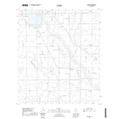
2020 Map of Dry Creek
USGS Topo · Published 2020About this map
Bundick Lake and its surrounding wetlands define the northern reaches of this Beauregard Parish landscape, where the waters of Bundick Creek flow through a complex network of bayous and gullies. The settlement of Dry Creek sits at a crossroads in the southeast, serving as a focal point for a region characterized by family-named landmarks and rural road networks. Extensive drainage features like Mill Bayou and Steep Gully illustrate the low-lying, water-dominant geography of southwestern Louisiana.
Find a feature on this map
98 named features on this map. Tap any name to fly to it.
Don’t see what you’re looking for? This feature index may not catch every label — zoom into the map to look around manually.
Map Details
Editions of this 2020 Dry Creek Map
This is the sole edition of this map. No revisions or reprints were ever made.
Other maps of this area

1935 · Mittie
USGS Topo · 1:31,680

1935 · Longville
USGS Topo · 1:31,680

1947 · Le Blanc
USGS Topo · 1:31,680

1947 · Ikes
USGS Topo · 1:31,680

1947 · Reeves
USGS Topo · 1:31,680

1947 · Longville
USGS Topo · 1:31,680

1947 · Grant
USGS Topo · 1:31,680

1947 · Bundick
USGS Topo · 1:31,680

1947 · Sugartown
USGS Topo · 1:31,680

1947 · Bannister
USGS Topo · 1:31,680