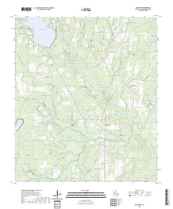
2024 Map of Dry Creek
USGS Topo · Published 2024About this map
Bundick Lake and the branching waters of Bundick Creek dominate the northern landscape of this Beauregard Parish quadrangle. The settlement of Dry Creek serves as a local hub, surrounded by a network of family-named roads such as Odis Greene Rd, Tommy Bailey Rd, and Frank Miller Rd. This intricate web of local thoroughfares reveals a long-standing pattern of rural homesteads and timber-related land use, evidenced by the presence of Old Tram Rd.
Find a feature on this map
96 named features on this map. Tap any name to fly to it.
Don’t see what you’re looking for? This feature index may not catch every label — zoom into the map to look around manually.
Map Details
Editions of this 2024 Dry Creek Map
This is the sole edition of this map. No revisions or reprints were ever made.
Other maps of this area

1935 · Mittie
USGS Topo · 1:31,680

1935 · Longville
USGS Topo · 1:31,680

1947 · Le Blanc
USGS Topo · 1:31,680

1947 · Ikes
USGS Topo · 1:31,680

1947 · Reeves
USGS Topo · 1:31,680

1947 · Longville
USGS Topo · 1:31,680

1947 · Grant
USGS Topo · 1:31,680

1947 · Bundick
USGS Topo · 1:31,680

1947 · Sugartown
USGS Topo · 1:31,680

1947 · Bannister
USGS Topo · 1:31,680