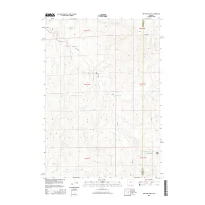
2015 Map of Dry Fork Ranch
USGS Topo · Published 2015About this map
The Bozeman Trl cuts across the high plains of the Powder River Basin, tracing a historic path through this ranching landscape along the border of Johnson and Campbell Counties. The drainage of the Dry Fork Powder River dominates the topography, fed by numerous seasonal waterways including Bullwhacker Cr, Little Bullwhacker Cr, and Seventeenmile Cr. These creek systems are punctuated by localized water management features like the Water Hole Reservoir and Artesian Upper Reservoir, which are vital for supporting the regional livestock industry centered on holdings like the Dry Fork Ranch.
Find a feature on this map
21 named features on this map. Tap any name to fly to it.
Don’t see what you’re looking for? This feature index may not catch every label — zoom into the map to look around manually.
Map Details
Editions of this 2015 Dry Fork Ranch Map
This is the sole edition of this map. No revisions or reprints were ever made.
Other maps of this area

1953 · Dry Fork Ranch
USGS Topo · 1:24,000

1953 · Fort Reno
USGS Topo · 1:24,000

1953 · Fort Reno SE
USGS Topo · 1:24,000

1953 · Rolling Pin Ranch
USGS Topo · 1:24,000

1953 · North Butte
USGS Topo · 1:24,000

1954 · House Creek
USGS Topo · 1:24,000

1954 · Artesian Draw
USGS Topo · 1:24,000

1954 · Linch
USGS Topo · 1:24,000

1954 · Taylor Ranch
USGS Topo · 1:24,000

1955 · Newcastle
USGS Topo · 1:250,000