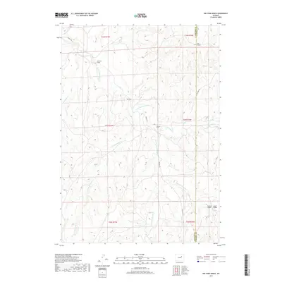
2017 Map of Dry Fork Ranch
USGS Topo · Published 2017About this map
Bozeman Trl cuts across this high plains landscape of the Powder River Basin, tracing a historic path through Campbell and Johnson Counties. The terrain is defined by an intricate network of seasonal drainages, including Dry Fork Powder River and the meandering Little Bullwhacker Cr. This 2017 survey reflects a remote ranching environment where development is sparse, centered primarily around the Dry Fork Ranch and localized access points like Red Springs Rd. The map illustrates the complex topography of the region, featuring named landmarks such as Beecher Draw and Del Gulch, alongside the deep incisions of Fletcher Canyon and Cedar Canyon. It serves as a precise record of the contemporary land use and hydrography in this part of Wyoming, where the legacy of pioneer trails meets modern-day rangeland management.
Find a feature on this map
20 named features on this map. Tap any name to fly to it.
Don’t see what you’re looking for? This feature index may not catch every label — zoom into the map to look around manually.
Map Details
Editions of this 2017 Dry Fork Ranch Map
This is the sole edition of this map. No revisions or reprints were ever made.
Other maps of this area

1953 · Dry Fork Ranch
USGS Topo · 1:24,000

1953 · Fort Reno
USGS Topo · 1:24,000

1953 · Fort Reno SE
USGS Topo · 1:24,000

1953 · Rolling Pin Ranch
USGS Topo · 1:24,000

1953 · North Butte
USGS Topo · 1:24,000

1954 · House Creek
USGS Topo · 1:24,000

1954 · Artesian Draw
USGS Topo · 1:24,000

1954 · Linch
USGS Topo · 1:24,000

1954 · Taylor Ranch
USGS Topo · 1:24,000

1955 · Newcastle
USGS Topo · 1:250,000