
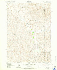
1953 Map of Dry Fork Ranch
USGS Topo · Published 1954About this map
The Cooks Seventeenmile Stage Station (Historical Site) sits near the confluence of Seventeenmile Creek and the Dry Fork Powder River, marking a point of transit across this expansive ranching landscape in Johnson and Campbell Counties. In the early 1950s, the area was defined by a network of seasonal camps and ranching outposts, including the Irvine Shearing Camp and the Taylor Cow Camp. Numerous Artesian Wells and Springs are scattered throughout the terrain, highlighting the critical importance of water access for livestock in an environment where named drainages like Beecher Draw, Tex Draw, and Cottonwood Creek often run dry. The map records the shifting nature of human settlement, noting the Nichols Ranch (Aband) while several Windmills remain active across the high ground between Bullwhacker Creek and Fletcher Canyon.
Find a feature on this map
22 named features on this map. Tap any name to fly to it.
Don’t see what you’re looking for? This feature index may not catch every label — zoom into the map to look around manually.
Map Details
Editions of this 1953 Dry Fork Ranch Map
3 editions found
Other maps of this area

1953 · Fort Reno
USGS Topo · 1:24,000

1953 · Fort Reno SE
USGS Topo · 1:24,000

1953 · Rolling Pin Ranch
USGS Topo · 1:24,000

1953 · North Butte
USGS Topo · 1:24,000

1954 · House Creek
USGS Topo · 1:24,000

1954 · Artesian Draw
USGS Topo · 1:24,000

1954 · Linch
USGS Topo · 1:24,000

1954 · Taylor Ranch
USGS Topo · 1:24,000

1955 · Newcastle
USGS Topo · 1:250,000

1955 · Arminto
USGS Topo · 1:250,000