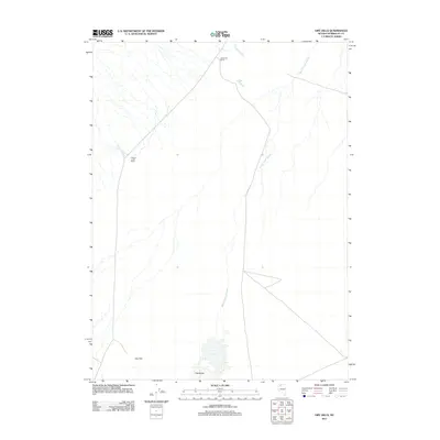
2011 Map of Dry Hills
USGS Topo · Published 2011About this map
Alexander Ranch and Willow Creek Ranch anchor this high-desert landscape in Humboldt County, illustrating the scale of rural land use in northern Nevada. The terrain is defined by the shifting hydrology of Bottle Creek Slough, which meanders across the central flats between the Dry Hills and extensive Hardpans to the south. These alkali flats and intermittent watercourses like Willow Creek and Boulder Creek indicate a drainage system that relies on seasonal runoff, a characteristic pattern for the Great Basin's interior basins. The map provides a precise look at the sparse road network and isolated ranching outposts that have historically managed these vast grazing lands.
Find a feature on this map
7 named features on this map. Tap any name to fly to it.
Don’t see what you’re looking for? This feature index may not catch every label — zoom into the map to look around manually.
Map Details
Editions of this 2011 Dry Hills Map
This is the sole edition of this map. No revisions or reprints were ever made.
Other maps of this area

1886 · Disaster
USGS Topo · 1:250,000

1893 · Disaster
USGS Topo · 1:250,000

1954 · Vya
USGS Topo · 1:250,000

1958 · Vya
USGS Topo · 1:250,000

1961 · Bottle Creek
USGS Topo · 1:62,500

1962 · Vya
USGS Topo · 1:250,000

1966 · Donna Schee Peak
USGS Topo · 1:62,500
1982 · Bottle Creek Slough SW
USGS Topo · 1:24,000
1982 · Presnel Well
USGS Topo · 1:24,000
1982 · Lay Waterhole
USGS Topo · 1:24,000