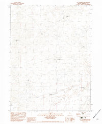
1982 Map of Lay Waterhole
USGS Topo · Published 1982About this map
The arid expanses of Humboldt County are defined here by a vital network of water sources necessary for ranching and survival in the Great Basin. This 1982 survey illustrates a landscape dominated by internal drainage basins, including the extensive Alkali Flat and Alkali Flats that cover the southern reaches. Human presence is marked primarily by named water improvements, such as the Mormon Dan Well and the namesake Lay Waterhole. These features, often located miles apart, underscore the region's reliance on groundwater management for livestock in an environment where surface water is scarce. Individual landmarks like Lee Windmill and the Barbara Worth Well provide critical orientation points for those navigating the open range between the shifting sands of the Sand Dunes Well and the seasonal catchment at Hidden Playa Well.
Find a feature on this map
12 named features on this map. Tap any name to fly to it.
Don’t see what you’re looking for? This feature index may not catch every label — zoom into the map to look around manually.
Map Details
Editions of this 1982 Lay Waterhole Map
This is the sole edition of this map. No revisions or reprints were ever made.
Other maps of this area

1886 · Disaster
USGS Topo · 1:250,000

1893 · Disaster
USGS Topo · 1:250,000

1931 · Lovelock
USGS Topo · 1:250,000

1935 · Lovelock
USGS Topo · 1:250,000

1954 · Vya
USGS Topo · 1:250,000

1955 · Lovelock
USGS Topo · 1:250,000

1958 · Vya
USGS Topo · 1:250,000

1959 · Lovelock
USGS Topo · 1:250,000

1962 · Vya
USGS Topo · 1:250,000

1966 · Donna Schee Peak
USGS Topo · 1:62,500