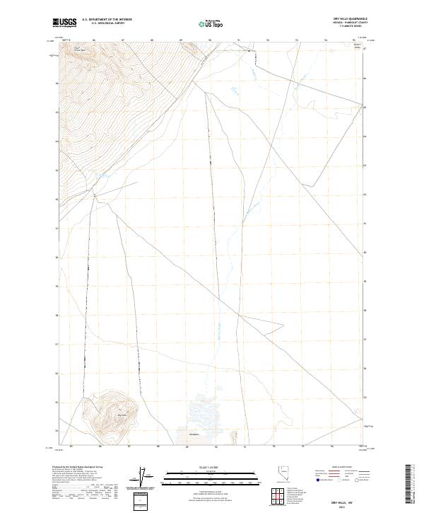
2021 Map of Dry Hills
USGS Topo · Published 2021About this map
Dry Hills rises above the basin floor in this corner of Nevada, where the drainage patterns of Bottle Cr Slough and Willow Cr define the seasonal water movement through the high desert. The landscape is characterized by its arid extremes, featuring expansive Hardpans and the open stretches of Desert Valley. This 2021 survey illustrates a sparsely developed region where Bottle Creek Rd provides primary access across the township lines. The topography transitions from the alluvial fans near Trout Creek Spur to the flat, alkaline basins, offering a clear record of the hydrography and terrain as it exists in the early 21st century.
Find a feature on this map
12 named features on this map. Tap any name to fly to it.
Don’t see what you’re looking for? This feature index may not catch every label — zoom into the map to look around manually.
Map Details
Editions of this 2021 Dry Hills Map
This is the sole edition of this map. No revisions or reprints were ever made.
Other maps of this area

1886 · Disaster
USGS Topo · 1:250,000

1893 · Disaster
USGS Topo · 1:250,000

1954 · Vya
USGS Topo · 1:250,000

1958 · Vya
USGS Topo · 1:250,000

1961 · Bottle Creek
USGS Topo · 1:62,500

1962 · Vya
USGS Topo · 1:250,000

1966 · Donna Schee Peak
USGS Topo · 1:62,500
1982 · Bottle Creek Slough SW
USGS Topo · 1:24,000
1982 · Presnel Well
USGS Topo · 1:24,000
1982 · Lay Waterhole
USGS Topo · 1:24,000