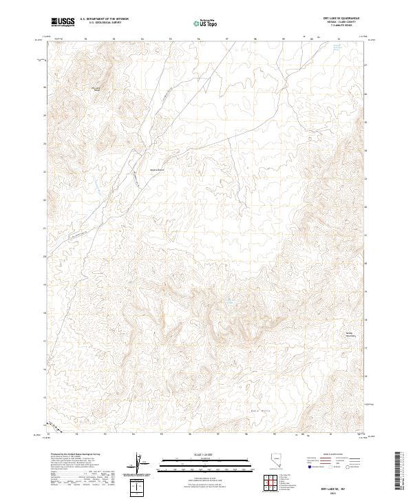
2021 Map of Dry Lake SE
USGS Topo · Published 2021About this map
Old Spanish Trail Rd cuts through the desert landscape, following a historic travel corridor between the Dry Lake Range and the Muddy Mountains. This 2021 survey of the Mojave Desert reveals a land defined by its drainage patterns, most notably the seasonal courses of California Wash and Gypsum Wash. The presence of the Union Pacific RR in the southwestern corner demonstrates the continued importance of the rail corridor for transcontinental transit through this part of Clark County.
Find a feature on this map
13 named features on this map. Tap any name to fly to it.
Don’t see what you’re looking for? This feature index may not catch every label — zoom into the map to look around manually.
Map Details
Editions of this 2021 Dry Lake SE Map
This is the sole edition of this map. No revisions or reprints were ever made.
Other maps of this area

1886 · Saint Thomas
USGS Topo · 1:250,000

1893 · Saint Thomas
USGS Topo · 1:250,000

1926 · Boulder Canyon
USGS Topo · 1:96,000

1952 · Dry Lake
USGS Topo · 1:62,500

1952 · Henderson
USGS Topo · 1:62,500

1953 · Muddy Peak
USGS Topo · 1:62,500

1953 · Hoover Dam
USGS Topo · 1:62,500

1954 · Las Vegas
USGS Topo · 1:250,000

1957 · Las Vegas
USGS Topo · 1:250,000

1959 · Las Vegas
USGS Topo · 1:250,000