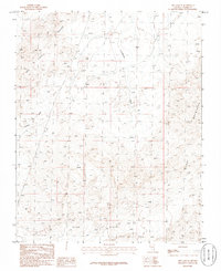
1986 Map of Dry Lake SE
USGS Topo · Published 1986About this map
The Gale Hills anchor the southern landscape of this Clark County region, as documented in a mid-1980s Usgs provisional study. The terrain is defined by its drainage patterns and prominent uplands, with the Dry Lake Range rising to the northwest and the Muddy Mountains dominating the eastern edge of the quadrangle. Significant desert drainage is captured here through California Wash and Gypsum Wash, which carve through the arid topography. This era of mapping focused on detailed elevation and manuscript drawings, providing a technical look at the landforms between the ranges before later-century shifts in the surrounding desert basin.
Find a feature on this map
5 named features on this map. Tap any name to fly to it.
Don’t see what you’re looking for? This feature index may not catch every label — zoom into the map to look around manually.
Map Details
Editions of this 1986 Dry Lake SE Map
This is the sole edition of this map. No revisions or reprints were ever made.
Other maps of this area

1886 · Saint Thomas
USGS Topo · 1:250,000

1893 · Saint Thomas
USGS Topo · 1:250,000

1926 · Boulder Canyon
USGS Topo · 1:96,000

1952 · Dry Lake
USGS Topo · 1:62,500

1952 · Henderson
USGS Topo · 1:62,500

1953 · Muddy Peak
USGS Topo · 1:62,500

1953 · Hoover Dam
USGS Topo · 1:62,500

1954 · Las Vegas
USGS Topo · 1:250,000

1957 · Las Vegas
USGS Topo · 1:250,000

1959 · Las Vegas
USGS Topo · 1:250,000