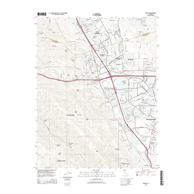
2015 Map of Dublin
USGS Topo · Published 2015About this map
San Ramon and Dublin anchor this 2015 study of the East Bay's Tri-Valley region, where suburban expansion meets the complex topography of the Diablo Range. The map illustrates a landscape shaped by rapid growth, with residential developments like Komandorski Village and San Ramon Village filling the valley floor near the junction of major transit corridors. This modern era of connectivity is anchored by the BART Sta, reflecting the transition from the area's agricultural past to its role as a regional tech and commuter hub.
Find a feature on this map
64 named features on this map. Tap any name to fly to it.
Don’t see what you’re looking for? This feature index may not catch every label — zoom into the map to look around manually.
Map Details
Editions of this 2015 Dublin Map
This is the sole edition of this map. No revisions or reprints were ever made.
Other maps of this area

1896 · Mt. Diablo
USGS Topo · 1:62,500

1897 · Concord
USGS Topo · 1:62,500

1898 · Mt. Diablo
USGS Topo · 1:62,500

1899 · Haywards
USGS Topo · 1:62,500

1906 · Pleasanton
USGS Topo · 1:62,500

1915 · Haywards
USGS Topo · 1:62,500

1915 · Concord
USGS Topo · 1:62,500

1941 · Pleasanton
USGS Topo · 1:62,500

1942 · Concord
USGS Topo · 1:62,500

1942 · Hayward
USGS Topo · 1:62,500