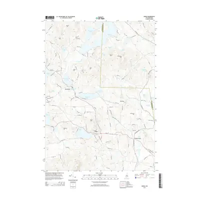
2015 Map of Dublin
USGS Topo · Published 2015About this map
Dublin serves as a central hub in this upland landscape, where a dense network of local roads such as Lower Jaffrey Rd and Old Stoddard Rd connects established settlements and mountain peaks. The geography is defined by an extensive series of reservoirs and natural ponds, including the large Nubanusit Lake in the north and the prominent Dublin Pond just south of the town center. The industrial and utilitarian history of the water is evident in the presence of Nubanusit Brook Reservoir, Seaver Reservoir, and Howe Reservoir, while the surrounding hills like Skatutakee Mtn and Thumb Mtn provide significant relief.
Find a feature on this map
125 named features on this map. Tap any name to fly to it.
Don’t see what you’re looking for? This feature index may not catch every label — zoom into the map to look around manually.
Map Details
Editions of this 2015 Dublin Map
This is the sole edition of this map. No revisions or reprints were ever made.
Other maps of this area

1898 · Monadnock
USGS Topo · 1:62,500

1900 · Peterboro
USGS Topo · 1:62,500

1926 · Hillsboro
USGS Topo · 1:62,500

1929 · Hillsboro
USGS Topo · 1:62,500

1930 · Lovewell Mountain
USGS Topo · 1:62,500

1936 · Monadnock
USGS Topo · 1:62,500

1942 · Keene
USGS Topo · 1:125,000

1942 · Lovewell Mountain
USGS Topo · 1:62,500

1943 · Fitchburg
USGS Topo · 1:125,000

1948 · Boston
USGS Topo · 1:250,000