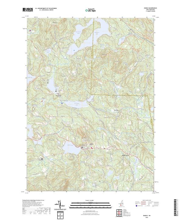
2024 Map of Dublin
USGS Topo · Published 2024About this map
Dublin and Harrisville anchor a landscape defined by significant water bodies and high points in the Monadnock Region. This contemporary survey traces a complex network of glacial ponds and brooks, including the sprawling Nubanusit Lake and Skatutakee Lake, which have historically driven the local milling and recreation economies. For those researching local lineages, the map identifies several key burial sites such as Dublin Town Cem, the waterside Island Cem, and Saint Denis Cem. The terrain is characterized by notable elevations like Thumb Mtn and Cobb Hill, with the Monadnock-Sunapee Greenway Trl cutting through the western hills. Small clusters of settlement at Bonds Corner and Eastview appear alongside educational landmarks like the Fairwood Bible Institute, providing a clear record of modern property boundaries and rural development across the Cheshire and Hillsborough county line.
Find a feature on this map
136 named features on this map. Tap any name to fly to it.
Don’t see what you’re looking for? This feature index may not catch every label — zoom into the map to look around manually.
Map Details
Editions of this 2024 Dublin Map
This is the sole edition of this map. No revisions or reprints were ever made.
Other maps of this area

1898 · Monadnock
USGS Topo · 1:62,500

1900 · Peterboro
USGS Topo · 1:62,500

1926 · Hillsboro
USGS Topo · 1:62,500

1929 · Hillsboro
USGS Topo · 1:62,500

1930 · Lovewell Mountain
USGS Topo · 1:62,500

1936 · Monadnock
USGS Topo · 1:62,500

1942 · Keene
USGS Topo · 1:125,000

1942 · Lovewell Mountain
USGS Topo · 1:62,500

1943 · Fitchburg
USGS Topo · 1:125,000

1948 · Boston
USGS Topo · 1:250,000