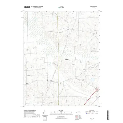
2019 Map of Dublin
USGS Topo · Published 2019About this map
The boundary between Hickman Co and Graves Co bisects a landscape defined by the shifting course of Obion Cr and its numerous tributaries. This rural area is anchored by small settlements such as Dublin, Baltimore, and Holifield, each connected by a network of local roads including Rohber Rd and Baltimore Church Rd. The region is notably rich in family and community burial grounds, providing a significant resource for genealogical research. Sites like Lain-Scholes Cem, Old Wingo-Greer Cem, and Pleasant Valley Cem are scattered across the terrain, often near former school sites like the one indicated by Folks School Rd. To the west, the wetland environments of Murphy Pond and Cypress Cr mark a distinct transition in the local geography near Nichols and Fulgham.
Find a feature on this map
60 named features on this map. Tap any name to fly to it.
Don’t see what you’re looking for? This feature index may not catch every label — zoom into the map to look around manually.
Map Details
Editions of this 2019 Dublin Map
This is the sole edition of this map. No revisions or reprints were ever made.
Other maps of this area

1951 · Milburn
USGS Topo · 1:24,000

1951 · Hickory
USGS Topo · 1:24,000

1951 · Hickory
USGS Topo · 1:62,500

1952 · Clinton
USGS Topo · 1:24,000

1952 · Mayfield
USGS Topo · 1:24,000

1952 · Dublin
USGS Topo · 1:24,000

1952 · Crutchfield
USGS Topo · 1:24,000

1952 · Cuba
USGS Topo · 1:24,000

1952 · Fancy Farm
USGS Topo · 1:24,000

1952 · Water Valley
USGS Topo · 1:24,000