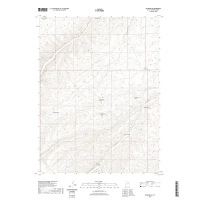
2020 Map of Duchesne SW
USGS Topo · Published 2020About this map
Indian Canyon and the high plateaus of Duchesne County define this landscape, where deep drainages like Wire Fence Canyon and Tabby Canyon carve through the arid terrain. The map documents a rugged interior network of routes including Sowers Canyon Rd and Cottonwood Ridge Rd, which provide access to the remote uplands of Cottonwood Ridge. In an area where water is the primary driver of both geology and human movement, Marshall Springs stands out as a critical localized water source. The seasonal flow of Sowers Cr snakes through its eponymous canyon, illustrating the erosion patterns that have shaped these basins over millennia. This 2020 data captures the area's contemporary geography, marking the intersection of natural drainage systems like Weeeint Hollow and Coyote Canyon with the established county road system.
Find a feature on this map
15 named features on this map. Tap any name to fly to it.
Don’t see what you’re looking for? This feature index may not catch every label — zoom into the map to look around manually.
Map Details
Editions of this 2020 Duchesne SW Map
This is the sole edition of this map. No revisions or reprints were ever made.
Other maps of this area

1885 · Uinta
USGS Topo · 1:250,000

1886 · Price River
USGS Topo · 1:250,000

1896 · Price River
USGS Topo · 1:250,000

1939 · Duchesne
USGS Topo · 1:125,000

1954 · Salt Lake City
USGS Topo · 1:250,000

1956 · Price
USGS Topo · 1:250,000

1958 · Salt Lake City
USGS Topo · 1:250,000

1960 · Salt Lake City
USGS Topo · 1:250,000

1960 · Price
USGS Topo · 1:250,000

1962 · Price
USGS Topo · 1:250,000