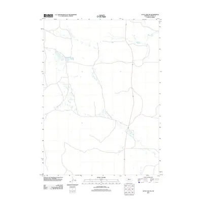
2011 Map of Duck Lake NE
USGS Topo · Published 2011About this map
Calf Creek meanders through the heart of the Nebraska Sandhills in this high-altitude cattle country. This landscape in Cherry County is characterized by a sparse network of local roads and unimproved trails that follow the natural contours of the interdunal valleys. The map illustrates a contemporary pattern of land use where large-scale ranching operations depend on the intermittent water sources and the vast, grass-covered dunes typical of this region of the Great Plains. Settlement is extremely limited, with the geography dominated by the subtle drainage patterns that feed into the local creek system, providing a detailed look at the hydrology of the rural interior.
Find a feature on this map
1 named feature on this map. Tap any name to fly to it.
Don’t see what you’re looking for? This feature index may not catch every label — zoom into the map to look around manually.
Map Details
Editions of this 2011 Duck Lake NE Map
This is the sole edition of this map. No revisions or reprints were ever made.
Other maps of this area

1948 · Seneca 4
USGS Topo · 1:62,500

1949 · Seneca 4
USGS Topo · 1:62,500

1949 · Purdum
USGS Topo · 1:62,500

1949 · Long Lake
USGS Topo · 1:62,500

1951 · Long Lake
USGS Topo · 1:62,500

1951 · Purdum
USGS Topo · 1:62,500

1951 · Brownlee
USGS Topo · 1:62,500

1957 · Valentine
USGS Topo · 1:250,000

1959 · Valentine
USGS Topo · 1:250,000

1985 · Goose Creek
USGS Topo · 1:100,000