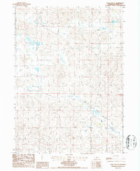
1986 Map of Duck Lake NE
USGS Topo · Published 1986About this map
Calf Creek Valley stretches across this portion of Cherry County, defining a landscape marked by the complex topography of the Nebraska Sandhills. In the mid-1980s, this area remained largely undeveloped, characterized by isolated water sources such as the Creek and several instances of a Well scattered across the township sections. The map reveals the intricate network of dunes and depressions typical of this region, where the survival of ranching operations depended on these specific, named water points. The surveyor's notes from 1983 and 1984 aerial photography document a remote prairie environment where section lines and small seasonal water bodies are the primary markers of human organization.
Find a feature on this map
5 named features on this map. Tap any name to fly to it.
Don’t see what you’re looking for? This feature index may not catch every label — zoom into the map to look around manually.
Map Details
Editions of this 1986 Duck Lake NE Map
This is the sole edition of this map. No revisions or reprints were ever made.
Other maps of this area

1948 · Seneca 4
USGS Topo · 1:62,500

1949 · Seneca 4
USGS Topo · 1:62,500

1949 · Purdum
USGS Topo · 1:62,500

1949 · Long Lake
USGS Topo · 1:62,500

1951 · Long Lake
USGS Topo · 1:62,500

1951 · Purdum
USGS Topo · 1:62,500

1951 · Brownlee
USGS Topo · 1:62,500

1957 · Valentine
USGS Topo · 1:250,000

1959 · Valentine
USGS Topo · 1:250,000

1985 · Goose Creek
USGS Topo · 1:100,000