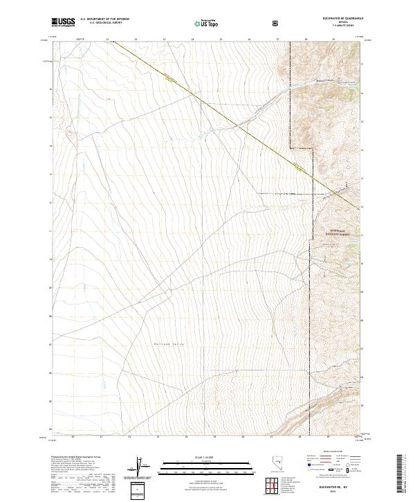
2021 Map of Duckwater NE
USGS Topo · Published 2021About this map
Railroad Valley dominates the western portion of this landscape, where the wide expanse of the valley floor meets the rising eastern foothills of the Humboldt National Forest. This 2021 survey shows a terrain defined by intermittent water sources and the transition from the arid basin to more complex canyon systems. Life in this corner of Nye County and White Pine County is centered on these remote water points, including Blackrock Spring, Vanover Spring, and Sawmill Spring. Access into the higher elevations is facilitated by the White River Trl and Vanover Spring Trl, which navigate the steep incisions of White River Pass Canyon and Blackrock Canyon. The presence of Natl Forest Develop Road 422 Rd provides a primary transit corridor across the northern sections, tracing the drainage of Black Canyon Wash.
Find a feature on this map
20 named features on this map. Tap any name to fly to it.
Don’t see what you’re looking for? This feature index may not catch every label — zoom into the map to look around manually.
Map Details
Editions of this 2021 Duckwater NE Map
This is the sole edition of this map. No revisions or reprints were ever made.
Other maps of this area

1949 · Treasure Hill
USGS Topo · 1:62,500

1950 · Treasure Hill
USGS Topo · 1:62,500

1951 · Green Springs
USGS Topo · 1:62,500

1956 · Lund
USGS Topo · 1:250,000

1956 · Ely
USGS Topo · 1:250,000

1957 · Currant Mtn
USGS Topo · 1:62,500

1959 · Ely
USGS Topo · 1:250,000

1960 · Lund
USGS Topo · 1:250,000

1963 · Ely
USGS Topo · 1:250,000

1964 · Duckwater
USGS Topo · 1:62,500